Trip planner and travel diary
Your own trip — planned in minutes, with you on the road, yours to keep.
Describe in two sentences where you want to go — by campervan, car, train or bike, as a family, as a couple or on your own. Wegweit turns that into a complete trip, day by day: the route, legs you can actually manage, places to stay, costs and a map. And the moment you set off it becomes your travel diary — your photos file themselves in.
Free to start · No card needed · Wegweit Plus from €3.99 a month (Pricing)

How it works
From the first sentence to the finished photo book — in three steps.
Tell us about your trip
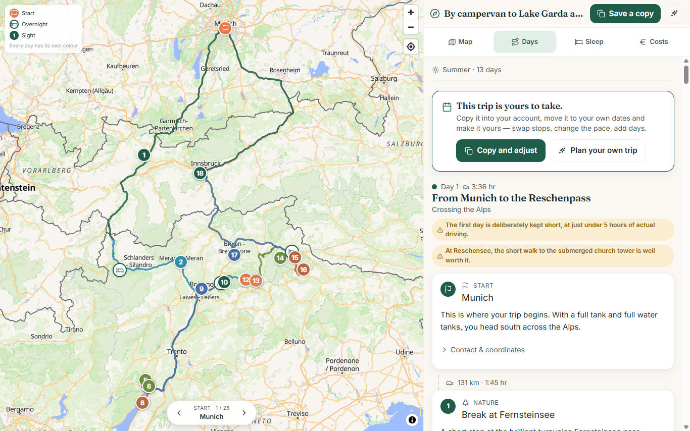
One sentence is enough: “We want two and a half weeks in the campervan in Scotland.” Add a few short fields — when you travel, where you start, the vehicle, the ages of the children. Minutes later you have a route that hangs together: stops worth the detour, legs children can cope with, pitches, ferry or Eurotunnel, honest costs including fuel.
On the road: set off and record it
The map, the day-by-day view, “send it to your sat-nav”. If things turn out differently, swap a stop or revise the trip in your own words — days already past stay untouched. And in the evening you upload the day's photos: they file themselves in, you add a short note, done.
Afterwards: share it, print it, keep it
The trip you planned has turned into a travel diary — with your photos in the right places. Send it to family and friends as an album link, with a password if you like. Or make a photo book out of it: seven styles, print-ready as a PDF.
Every stop in detail
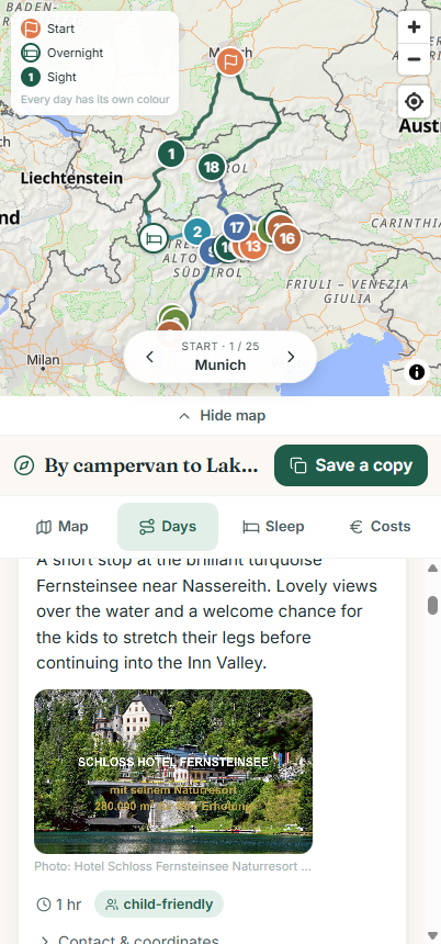
Everything you need to set off
Every stop comes with a short, readable description and real photos of the place — including campsites and pitches that are otherwise hard to find at all.
Costs in view
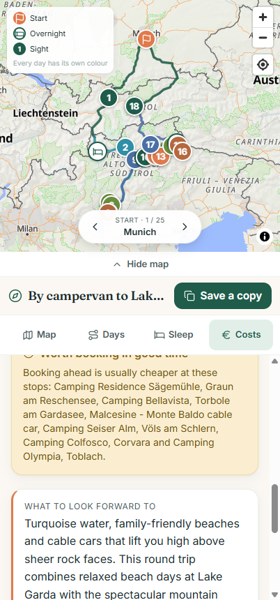
Roughly what the trip will cost — fuel included
No nasty surprises: from the start you see a rough total — diesel by distance and consumption, ferries and tunnels, places to stay and the stops themselves.
Travel diary
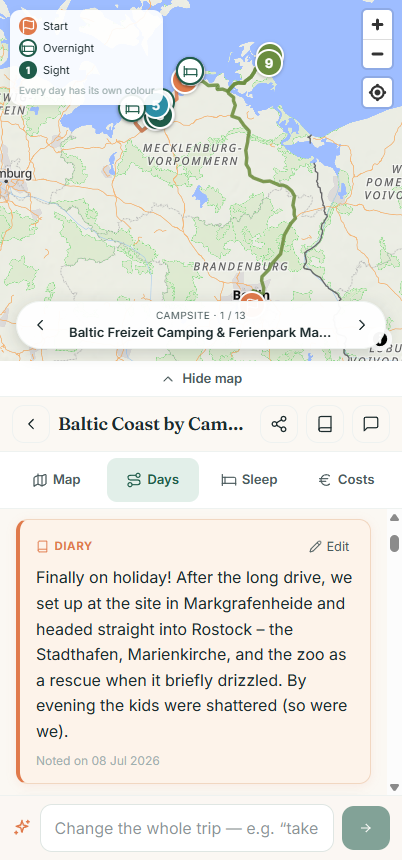
Your photos find their place — on their own
Upload the day's pictures in the evening and Wegweit does the rest: the date taken and the GPS put every photo on the right day and at the nearest place. Because the plan is already there, the diary doesn't have to be written — it fills itself.
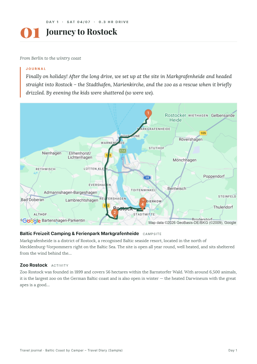
Share and print
What you end up with is a book, not a folder full of pictures
The same trip gives you both: an album to send round and a photo book to print. Day by day, with your notes, the maps of each leg and your photos. No sorting, no second app.
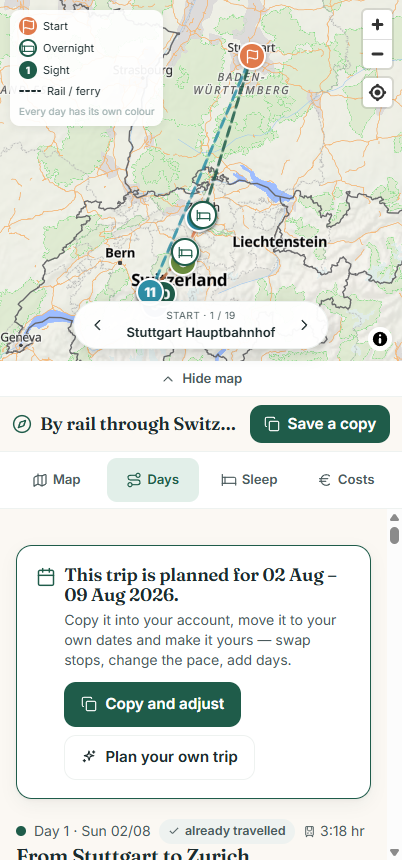
Not just campervans
By train and by bike as well
Rather travel car-free? Wegweit plans trips by train and ferry just as readily, or proper cycling tours — with real cycle routes, daily distances you can manage and places to stay that fit.
Why Wegweit
Made for everyone who wants to travel their own way.
No package holiday, no marathon of forms. Wegweit takes on the research you would otherwise spread across dozens of tabs — and afterwards the sorting that nobody ever gets round to.
Family pace
Legs that really work with children — matched to how many they are and how old they are, not 600 kilometres in one go.
Campervan logic
Pitches and campsites, time to set up before dusk, ferry versus Eurotunnel, and an eye on the trailer.
Swap stops
Adjust, replace or remove single stops. The leg affected is put back together cleanly.
Revise it in words
“Make day 3 more relaxed” or “more beaches” — the trip is replanned without you starting again.
Photos without the sorting
Uploading is enough. The date taken and the GPS put every picture on the right day and at the right place.
Notes like a diary
A few lines on every place and every day — typed on the road, or later at home on the sofa.
Sharing without an account
The plan and the album come as a link that grandparents and fellow travellers can open without signing up — the album with a password if you like.
A photo book to print
A print-ready PDF in seven styles, set in real typefaces. Your travelling year for the shelf instead of the hard drive.
A map at no extra cost
A tidy, Google-Maps-like map with the route, your position and the stops — for Germany and Europe.
Example trips
Real trips, made with Wegweit.
To Lake Garda by campervan
Over the Alps to turquoise water and on into the Dolomites — a round trip from Munich.
View the trip RailThrough Switzerland by train
Zurich, Lucerne and the Bernese Oberland — mountain railways and lakes, entirely without a car.
View the trip BikeAround Lake Constance by bike
The Lake Constance cycle path with the family — swimming spots, ferries and short days.
View the tripAnd if you don't know where to go yet: some travellers make their travel diary public — to browse, to save and to travel yourself.
Common questions
Good to know.
What is Wegweit?
Wegweit is a trip planner and a travel diary in one. From a short description and a handful of fields comes a complete, shareable trip day by day — with a map, stops, places to stay, costs and a PDF. On the road it becomes your travel diary: photos file themselves in by the date taken and their GPS, and your notes join them. At the end you have an album to share and a photo book to print. It plans for Germany and Europe, whether you travel by campervan, car, train or bike, and whether as a family, as a couple or on your own.
What does Wegweit cost?
There is a free account and the Wegweit Plus subscription. The free account includes: 1 new AI-planned trip per six months, 15 AI changes per 30 days (1 of them a full replan of the whole trip), 20 place searches a day and 20 photos of your own per trip — plus the map, the day-by-day plan, costs, navigation, sharing, publishing, the album link, the travel diary, pictures from Wikipedia and all the booking links. Deleting stops, adding days and reordering them is always free. Wegweit Plus costs €3.99 a month or €39.90 a year and unlocks the PDF guide, the photo book PDF, the password for the album, real photos of the places from Google, a new AI trip per month, 60 AI changes (3 of them full replans) and 300 photos per trip. If you only need one single trip in full — or a second one in the same month — you can unlock it one-off for €6.99. All prices include VAT; what currently applies to your account is shown at wegweit.com/en/preise. The map is token-free and never costs anything extra.
Which countries and regions does the planning work for?
Germany and the whole of Europe — from the North Sea across the Alps to the south of England or Scandinavia.
Does it work with a motorhome, a campervan and a caravan too?
Yes. Wegweit thinks about pitches and campsites, about time to set up, about ferry versus Eurotunnel and about the restrictions that come with a trailer. A VW T6 California towing a caravan can be planned just as well as an ordinary car.
Does Wegweit really plan with children in mind?
Yes. You give the number of children and their ages, and the daily legs are planned more gently to match — with driving times children can cope with and stops that suit families.
Can I add my own photos?
Yes, and that is the heart of the travel diary. You upload a day's pictures, Wegweit reads the date taken and the GPS and assigns every photo to the right day and to the nearest place. Pictures away from the route appear as pins of their own on the map. The location data is removed from the image file when it is saved.
Can I share, send or print the trip?
Yes, in three ways. The plan comes as a read-only link that anyone can open without an account. The travel diary has an album link of its own — without costs and places to stay, and with a password if you like. And for printing there is the PDF guide as well as a photo book PDF in seven styles. Sharing and the album link are free; the two PDFs and the album password belong to Wegweit Plus. Every link can be revoked at any time.
Are my trips visible to everyone?
No. Your trips are private, and a shared link is known only to the people you give it to. If you want, you can expressly publish a trip you have travelled — it then appears under “Discover trips” and can be found through search engines. That is a deliberate opt-in with its own consent, and you can revoke it at any time.
Do I need an account?
To plan your trips and find them again, you sign in — with an email code or with your email address and a password. Shared trips and albums can be opened by anyone, with or without an account.
Where is your next trip going?
Tell us briefly what you have in mind — we take care of the rest. In a few minutes you have a finished trip, ready to set off. And when you are back, you have the travel diary to go with it.